


Federal state of Saarland

State flag of Saarland
Image: public domain
1 Land and People
As of December 31, 2024, 1,012,141 people lived in Saarland, an area covering 2,569 square kilometers. That means there are 394 people per square kilometer. Most residents of Saarland speak standard German, but several dialects are still spoken. Because of its proximity to France and Luxembourg, many also speak French.
The Saarland has been part of the Federal Republic of Germany only since 1957. It borders the European countries of France and Luxembourg. Rhineland-Palatinate is the Saarland’s only neighbouring federal state. Today’s Saarland suffered greatly during the Thirty Years’ War, which lasted from 1618 to 1648. Much of the population at the time lost their lives, and large areas of the region lay desolate after the war. Many people from France, Belgium, Tyrol and Switzerland moved into the deserted areas. In the 19th century, many workers came to the Saarland to work in the coal mines and the iron and steel industry.
Even today, people with a migration background live in Saarland. This applies to about one in five residents. The term refers to people who, or whose parents, were not born in Germany.
You can also explore this state on a map. To do so, click on this link and enter the name of a place in the search box.
Find out:
1. How many people live in Saarland?
2. How large is the country?
3. Which German states and European countries border Saarland?
2 The state capital

Old bridge in Saarbrücken, the state capital
Image: State Capital Saarbrücken
The capital of Saarland is Saarbrücken. The city lies on the River Saar and had a total population of 181,959 at the end of 2022. It was formed in 1909 when the previously independent towns of Saarbrücken, St. Johann and Malstatt-Burbach merged. Saarbrücken is the only major city in the state of Saarland. The Ludwigskirche is considered the city’s landmark. This magnificent Protestant church was completed in 1775 in the Baroque style. In 1748, the ruling princes completed the three-winged palace in the city center on the banks of the Saar. Today it houses government offices and a museum.
Find out:
4. What is the state capital?
5. What is this city known for, for example?
3 Cities, Districts and Municipalities

Town Hall of the State Capital Saarbrücken
Image: State Capital Saarbrücken
Other towns in Saarland include Neunkirchen, Homburg, Völklingen, Sankt Ingbert and Saarlouis. Saarland has 17 towns and 35 other municipalities. The state is divided into 6 districts.
In every district, city and municipality, men and women are regularly elected to discuss and vote on important matters. Their assembly is called a district council, city council or municipal council. Districts are headed by elected district administrators, while mayors are elected in municipalities and cities. Each serves a term of 10 years.
Find out:
6. What other large cities are there in Saarland?
7. Who is in charge of counties, cities and municipalities?
4 Rivers

The Saarschleife near Merzig
Image: Hamsterkiste
The Saar , which gave the state its name, is 235 km long. It is formed by two headwaters in France, the Red Saar and the White Saar, and then flows for 68 km through Saarland. In the neighbouring state of Rhineland-Palatinate, it joins the Moselle near Konz. The Saar Loop near Merzig is well known. Here the Saar takes a 10 km detour on its way to Mettlach, following a tight curve.
The Blies is a 99 km-long tributary of the Saar. It rises in the small village of Selbach in the district of St. Wendel and then flows south. For 16 km, it forms the border with France. It joins the Saar in the town of Sarreguemines, known in German as Saargemünd. The Prims rises in the Hunsrück in Rhineland-Palatinate. It first flows south and reaches the Saarland near the town of Nonnweiler. Here, the Prims has been dammed to create a reservoir. After 91 km, it joins the Saar near Dillingen.
Find out:
8. Which rivers flow through Saarland?
5 Mountains and Landscapes

View from Hölschberg near Biesingen across the Bliesgau
Image: Mstp77 (CC BY-SA 3.0
The Schwarzwälder Hochwald lies in the north of the state. It is part of the Hunsrück range and stretches from Mettlach into Rhineland-Palatinate. On the border between the two states is Saarland’s highest mountain, the 695-meter-high Dollberg. The Schaumberg is in the district of St. Wendel, near the village of Theley. It is 569 meters high and rises above an otherwise flat landscape. That is why it is also known as the “local mountain of Saarland.” The Saargau stretches west of the Saar River, from south to north, as far as Konz in Rhineland-Palatinate. This rolling hill country is intensively farmed, and its highest points are about 400 meters high. The Saarkohlenwald covers an area of about 60 km² between Saarbrücken and Neunkirchen. This forest was once heavily exploited for commercial purposes: its wood was turned into charcoal or used in mining. Today, it is a popular recreation area. The Bliesgau is a gently rolling landscape that follows the Blies River. Its characteristic features include the river’s floodplain, bordered by large orchards or dense beech forests.
Find out:
9. What is the highest mountain in Saarland?
10. Which mountain ranges and distinctive landscapes can be found in this state?
6 Saarland and France

Saargemünd railway station. The town is in France.
Image: Röhrensee (CC BY-SA 4.0)
The Saarland has been part of neighboring France several times throughout its history. In the last century, after the First World War, it was administered for 15 years by the League of Nations, the predecessor of the UN. After the Second World War, it was part of the French occupation zone and remained under French influence from 1947 to 1956. At first, the Saarland was not allowed to join the Federal Republic of Germany, founded in 1949. Its economy was linked to France, with the franc as its currency. During this period, Saarlanders had their own nationality and, for example, competed with their own teams at the Olympic Games and in qualifying matches for the Football World Cup. In 1956, Germany and France agreed that the Saarland would join the Federal Republic. On January 1, 1957, it became a new federal state of the Federal Republic. The Deutsche Mark was not introduced until July 6, 1959.
Find out:
11. Which European country has the Saarland also belonged to?
12. Since when has it been a federal state of the Federal Republic of Germany?
7 Large Companies
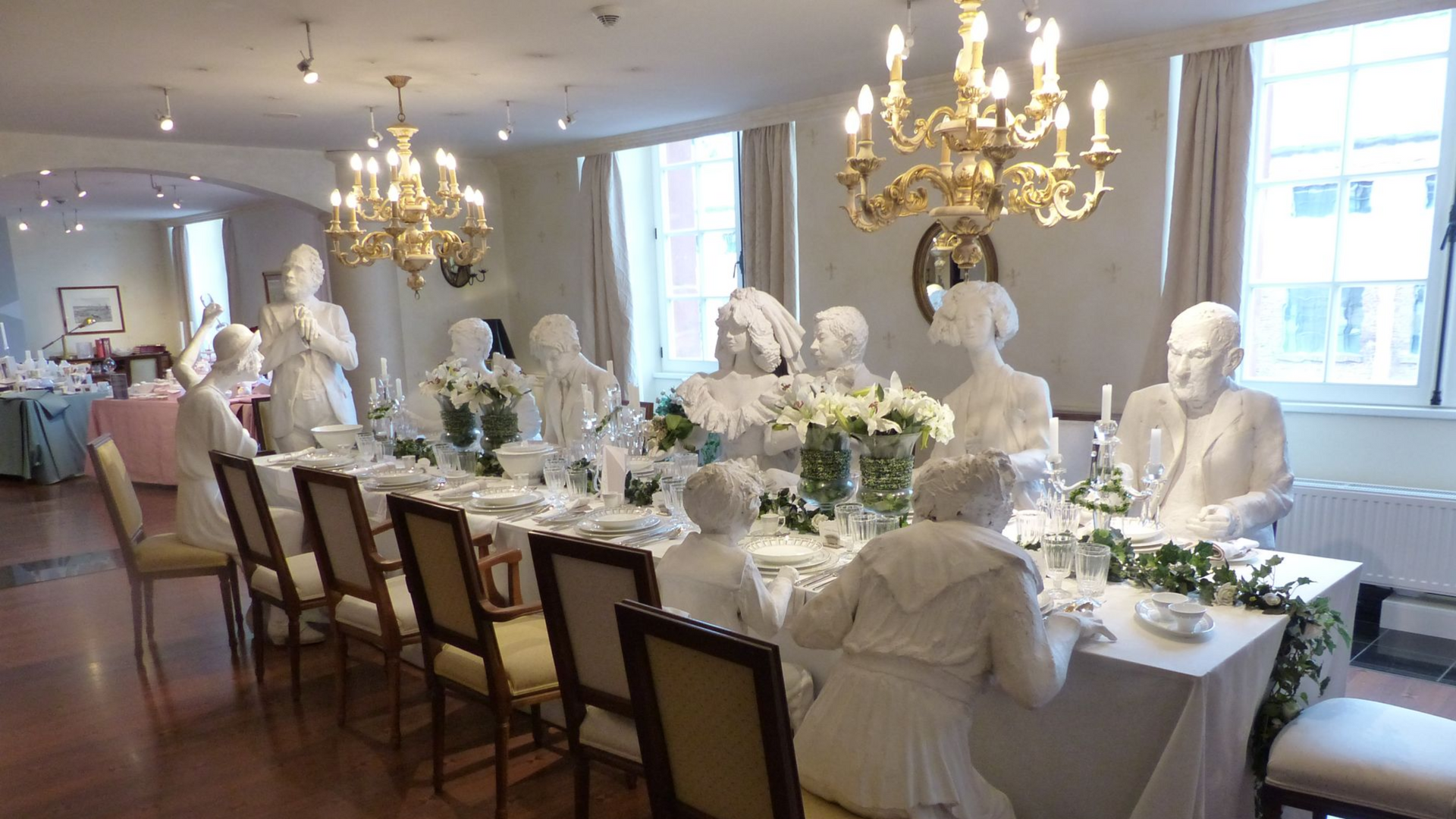
Banquet table at the Villeroy & Boch Museum Mettlach
Image: Hamsterkiste
In the past, many people in Saarland worked in coal mining. The last mine in Saarland closed in 2012. Today, the automotive industry is a major employer. Ford has a factory in Saarlouis, and automotive suppliers Bosch, INAand Michelin are in Homburg. The company ZF Getriebe has a branch in Saarbrücken, and the company Ebersbächer is based in Neunkirchen. The Saarstahl AG and the AG der Dillinger Hüttenwerke in Völklingen and Dillingen are two major steel companies. The company Villeroy & Boch AG from Mettlach manufactures ceramic goods. In the IT sector, the companies IDS Scheer in Saarbrücken and SAP AG in St. Ingbert are active.
Find out:
13. What major companies are there in Saarland?
8 Parliament and Government

Members of the Saarland State Parliament meet in this building
Image: Hamsterkiste
Laws for the state of Saarland are passed by the members of the state parliament. The Saarland State Parliament meets in the state capital, Saarbrücken. The most recent state election was held on March 22, 2022. Fifty-one men and women were elected as members of parliament for five years. The following parties are represented in the state parliament. The number of members of parliament is shown after each party name.
- CDU 19
- SPD 29
- AfD 3
After the March 2022 election, the SPD held a majority in the state parliament on its own. Its state chair, Anke Rehlinger, was elected Minister-President.
Find out:
14. What is the name of the parliament that passes laws for the country?
15. Which parties are currently represented in the state parliament?
16. Who is the current state premier?
17. Which political party does she belong to?