


The Elbe
On the Elbe
Video: Hamsterkiste
You could do this:
- Watch the video together. Talk about what you saw.
- Now look at the course of the Elbe on the map. Which places do you know?
- Read the individual chapters on your own first. Are there any words you didn’t understand?
- Write down 2 questions for each chapter. Give them to another child and ask them to answer in writing. Discuss your questions and answers with the whole class.
- Read each chapter aloud to a reading partner. Take turns reading.
- Write down all the places mentioned in the chapters. Find them on a map.
- Should houses be built on the Elbe meadows?
- List the Elbe’s tributaries and find out how long they are.
1 The course of the Elbe

The Course of the Elbe
Map: OpenStreetMap / Edited by: Hamsterkiste
2 The source

The source of the Elbe is in the Giant Mountains, at an altitude of 1,386 m
Image: Hagen Lutz
The Elbe is 1,094 kilometres long, making it one of the longest rivers in Europe. It rises in the Czech Republic, then flows through several German states and empties into the North Sea near Cuxhaven.
The source of the Elbe lies in the Giant Mountains at an altitude of 1,386 meters. After just one kilometer, it forms a tall waterfall, the Elbe Falls. In the Czech Republic, the river is called the Labe.
It first flows for around 60 kilometres through the Giant Mountains, with their many valleys. Along this stretch, it descends more than 1,000 metres.
Electricity is generated at many reservoirs and weirs. In some places, the water has carved deeply into the mountains, leaving high rock walls on either side.
3 The Elbe Sandstone Mountains

The Bastei offers a wonderful view of the Elbe - Image: Hamsterkiste

Bernardo Bellotto (Canaletto), The Königstein Fortress, 1756–1758 - public domain
On its way to Germany, the Elbe then passes through the Elbe Sandstone Mountains, which extend into both the Czech Republic and Saxony. Still in the Czech Republic, it first flows through the city of Děčín. The part of the Elbe Sandstone Mountains located in Germany is also known as the Saxon Switzerland .
The Bastei, a rock formation on the right bank of the Elbe, is particularly famous. There is a viewing platform here, 194 metres above the river, offering wonderful views over the Elbe and the Elbe Valley. A sandstone bridge was built in 1851. It is 76 metres long and spans a 40-metre-deep ravine called Mardertelle.
Another sight worth visiting is Königstein Fortress, perched on a high mountain right beside the Elbe, which makes a wide bend here. It is one of the largest mountain fortresses in Europe. Its walls are up to 42 meters high. The fortress was never conquered.
The painter Bernardo Bellotto, who called himself Canaletto, painted a famous depiction of Königstein Fortress between 1756 and 1758.
4 The Elbe meadows

Near Dresden, the banks of the Elbe are characterized by wide floodplains - Image: Hamsterkiste

Elbe meadows near Dresden - Image: Martin Röll (public domain)
After passing through Saxon Switzerland, the Elbe flows through the Saxon Hills . This 45 km stretch between the towns of Pirna and Meißen is also known as the Elbe Valley Basin or the Elbe Valley. The city of Dresden lies in this valley. The Elbe meadows, also known as the Elbe floodplains, are typical of this stretch.
These are strips of land along the banks of the Elbe. They are up to 400 meters wide and stretch for 30 km through the city of Dresden. When the Elbe is high, the water can spread out here.
5 The Middle Elbe
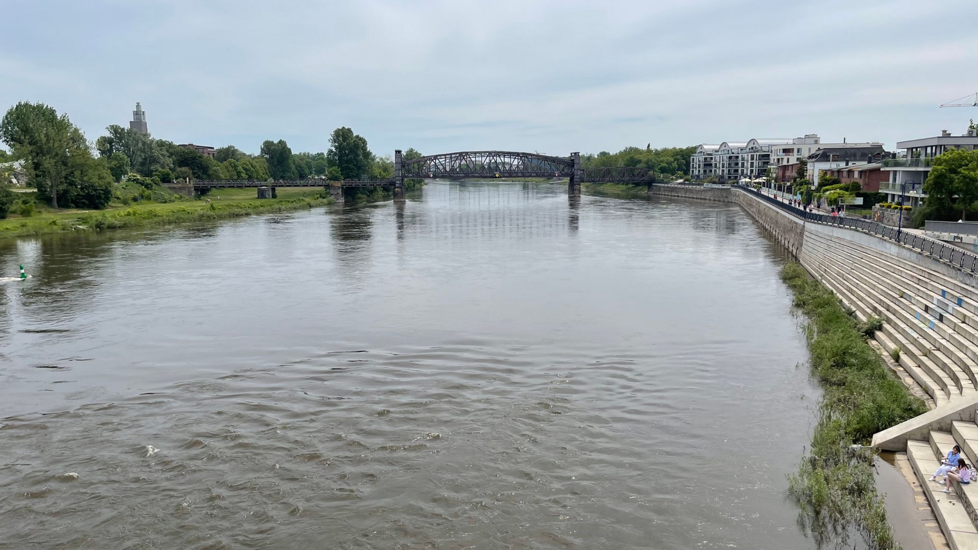
The Stern Bridge near Magdeburg

The Elbe near Hitzacker in Lower Saxony - Images: Hamsterkiste
The next stretch of the Elbe is called the Middle Elbe. From around Riesa, the Elbe flows northwest into the North German Plain . The river course here was formed after the last Ice Age.
Beyond Magdeburg, the Elbe flows north and northeast. After the Havel joins it, the river resumes its northwestward course. Here, it flows mainly over sandy soils. Many glacial erratics lie in the riverbed, left behind by the Ice Age, although many have been removed to prevent them from endangering shipping.
In addition to Magdeburg, other cities along the Middle Elbe include Torgau, Wittenberg, Dessau-Roßlau, and Wittenberge.
6 The Lower Elbe
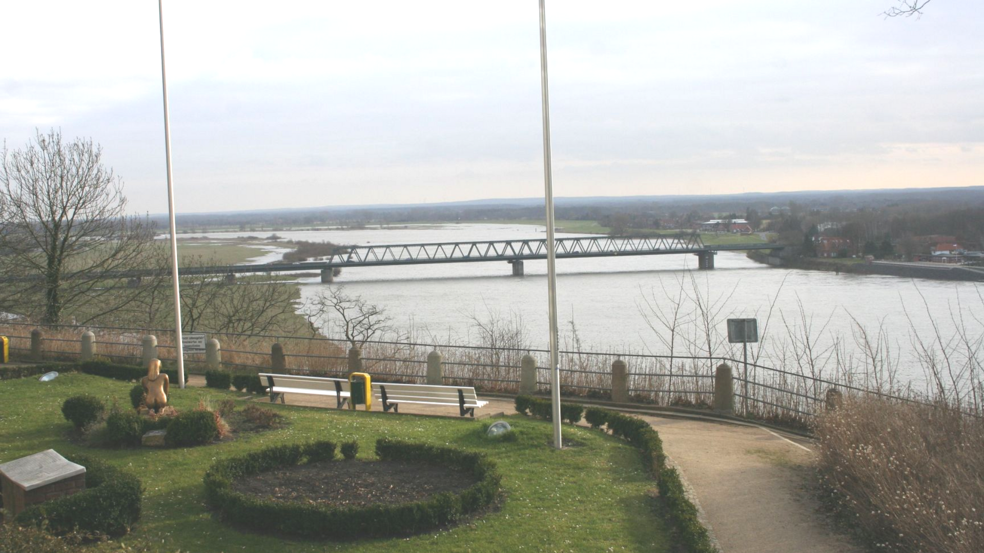
The Elbe near Lauenburg

The Geesthacht barrage – Image: Müllerchen (CC BY-SA 3.0)
The city of Geesthacht is about 35 km southeast of Hamburg in Schleswig-Holstein. The Lower Elbe begins here. A barrage holds back the Elbe here by up to 4 meters.
The marshlands lie on both sides of the Lower Elbe. The soil is very fertile. The “Altes Land” fruit-growing region southwest of Hamburg is a well-known example. In Hamburg, the Elbe divides into two large branches. They enclose the island of Wilhelmsburg. Hamburg’s port developed along small side channels.
7 The Lower and Outer Elbe

The Port of Hamburg
Image: Hamsterkiste
Beyond Hamburg, the Elbe is sometimes called the Lower Elbe. There is heavy shipping traffic here between the North Sea and the Port of Hamburg. Although Hamburg lies around 100 kilometres from the sea, it is home to Europe’s third-largest container port.
Large ships with a draft of more than 13 meters can sail on the Lower Elbe because the river has been dredged to that depth. In the past, the Elbe just before Hamburg was only 8 to 9 meters deep.
Just beyond Hamburg, the Elbe is 1.5 kilometres wide. By the time it reaches its mouth at Cuxhaven, it has widened to as much as 18 kilometres. At Glückstadt, you can cross the Elbe by ferry. A little farther north, the Kiel Canal branches off, allowing seagoing ships to travel to the Baltic Sea.
The Outer Elbe is the stretch of the river that flows through the Wadden Sea into the open North Sea. The islands of Neuwerk and Scharhörn are located here. They belong to the state of Hamburg.
8 The Elbe’s Tributaries

The Havel in the municipality of Schwielowsee in Brandenburg
Image: Hamsterkiste
The Elbe has numerous tributaries. The
Vltava
flows through Prague, the capital of the Czech Republic. It is 430 kilometers long in total. North of Prague, it flows into the Elbe.
The Eger is 291 kilometres long and rises in the Fichtel Mountains in Bavaria. It then flows through northern Czechia and joins the Elbe at Litoměřice.
The Saale also rises in the Fichtel Mountains. It is 413 kilometers long and joins the Elbe at Barby in Saxony-Anhalt.
The Black Elster rises in Lusatia in Saxony and, after 179 km, joins the Elbe near the town of Elster in Saxony-Anhalt.
The Mulde is formed where the Freiberger Mulde and Zwickauer Mulde meet. From their confluence, it is 147 km long. It flows into the Elbe near Dessau-Roßlau.
The longest right-bank tributary of the Elbe is the Havel. It rises in Mecklenburg-Western Pomerania and flows through Berlin and Brandenburg toward the Elbe. The Havel is 334 kilometers long.
The Elde is a river in Mecklenburg-Western Pomerania. It flows through several large lakes in the state. It is 208 kilometres long and meets the Elbe at Dömitz.
The Oste is 153 km long and is the longest tributary of the Lower Elbe. It flows into the Elbe near Neuhaus.